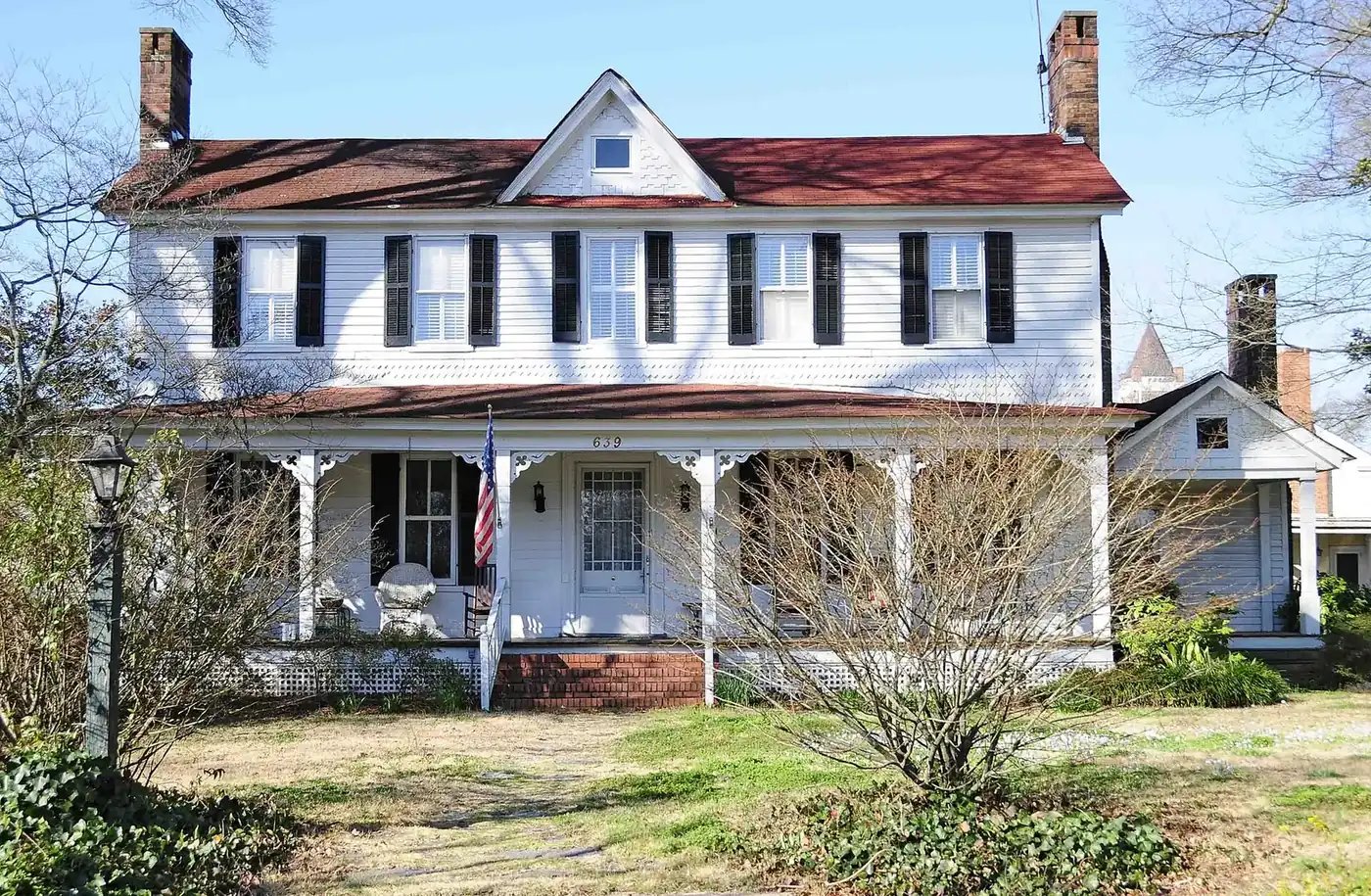
Nine Rock Hill areas, from Old Town and Oakland Avenue to Ebenezer and Riverwalk: zoned high school, I-77 exit and August 2026 home value for each.
Last checked Oct. 12, 2026. Sources: the City of Rock Hill’s neighborhoods map, Old Town map, zoning map, city limits, historic preservation page and Southside Rock Hill Historic Resource Survey (PDF), York County’s school attendance boundaries, South Carolina’s 2025 school report cards, OpenStreetMap, the U.S. Census Bureau and Zillow Research.
Rock Hill has about 75,259 residents, according to the Census Bureau’s 2020-2024 American Community Survey on its QuickFacts page. This guide splits the city into nine areas that a city map, a city plan or a historic survey names and draws, with a page for each: where it is, which schools it is zoned for, what homes in its ZIP code are worth, its parks and how far it is from I-77, City Hall and the airport.
What this means for you
- Schools: all 803 points we checked across the city fell in Rock Hill Schools (York School District 3) zones, but zones are drawn street by street. Check the exact address with the School Zone Locator.
- Home values: the Zillow Home Value Index was $287,994 for ZIP code 29730 and $351,937 for 29732 in August 2026.
- Taxes: one York County bill covers city, county and school levies; see our property taxes guide.
How the city is laid out
The city limits, as drawn on the city’s January 2026 city limits map, cover about 55 square miles of York County, with many unincorporated pockets inside and around them. Downtown, which the city calls Old Town, sits near the middle. I-77 runs north and south along the east side, with exits from 73 (S.C. 901) to 83 (Sutton Road) serving the city, and the Catawba River runs past Riverwalk on the east.
Most of the city is in two ZIP codes: 29730, covering downtown, the south and the east, and 29732, covering the north and west. The Winthrop University campus has its own ZIP code, 29733. ZIP codes, city limits and school zones do not line up: a Rock Hill mailing address can be outside the city, and Rock Hill Schools’ zones run well beyond the city line.
The city has no single official list of neighborhoods. It maps six neighborhood associations that work with its neighborhood empowerment program, draws the Old Town area on its own map, names master-planned developments such as Riverwalk on its zoning map, and recognizes five National Register historic districts.
Map
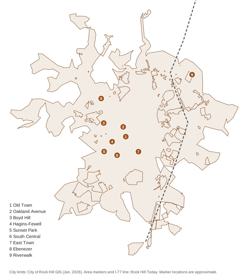
City limits from the City of Rock Hill’s GIS (January 2026); markers placed by Rock Hill Today.
The nine areas at a glance
| # | Area | ZIP code | Zoned high school | Home value in its ZIP, August 2026 |
|---|---|---|---|---|
| 1 | Old Town | 29730 (mostly) | Split: Northwestern, Rock Hill, South Pointe | $287,994 |
| 2 | Oakland Avenue and Winthrop | 29730, 29732, 29733 | Split: Northwestern, Rock Hill, South Pointe | $287,994 (29730) |
| 3 | Boyd Hill | 29732 | Northwestern | $351,937 |
| 4 | Hagins-Fewell | 29730 | Northwestern | $287,994 |
| 5 | Sunset Park | 29730 | Northwestern | $287,994 |
| 6 | South Central | 29730 | Split: South Pointe, Northwestern | $287,994 |
| 7 | East Town | 29730 | Mostly Northwestern; part South Pointe | $287,994 |
| 8 | Ebenezer | 29732 | South Pointe | $351,937 |
| 9 | Riverwalk | 29730 | Rock Hill High | $287,994 |
All three high schools were rated Average on South Carolina’s 2025 report cards. Home values are the Zillow Home Value Index for the whole ZIP code, a modeled typical value for the middle third of homes, not a sale price. Zillow’s figure for the City of Rock Hill was $323,886, down 1.7% from a year earlier. More in our home prices guide and schools guide.
The areas
1. Old Town. The city’s mapped historic core, about 4.3 square miles around downtown, from Winthrop in the north to Crawford Road in the south. It holds the Downtown, Marion Street Area and Reid Street-North Confederate Avenue historic districts, Fountain Park and Glencairn Garden.
2. Oakland Avenue and Winthrop. The 1891 Oakland neighborhood’s main street, running from downtown to the Winthrop University campus, with the Winthrop College and Charlotte Avenue-Aiken Avenue historic districts.
3. Boyd Hill. A 153-acre neighborhood west of downtown along Constitution Boulevard, beside the city’s Boyd Hill Recreation Center.
4. Hagins-Fewell. An 85-acre neighborhood of older streets on the west side of Old Town, with Arcade Victoria Park and the Winston Searles Trail.
5. Sunset Park. Platted from 1940 around Friedheim Park and extended into the late 1960s, on the southwest side; its elementary school is inside the neighborhood.
6. South Central. About 182 acres south of downtown along Crawford Road and Carolina Avenue, next to the Emmett Scott Recreation Center.
7. East Town. About 215 acres of older blocks along East Main, Black and White streets, from Fountain Park east, the closest of the nine to I-77 Exit 77.
8. Ebenezer. The church village on Ebenezer Road that predates Rock Hill; the railroad’s choice to bypass it in the 1840s gave the city its start.
9. Riverwalk. A 721-acre master-planned area on the Catawba River, home of the velodrome, BMX track and the north end of the Catawba River Trail.
Areas we left out
- Crawford Road North, a sixth area on the city’s neighborhoods map, covers about 29 acres between Crawford Road and South Heckle Boulevard, next to Sunset Park; every point we checked there was zoned for Sunset Park Center for Accelerated Studies, Rawlinson Road Middle and South Pointe High.
- Named subdivisions that OpenStreetMap lists inside the city, such as Westerwood Acres or Winthrop Heights, and single developments on the zoning map, such as Laurel Creek: each is a single subdivision, not a district a city plan describes.
- Mill villages such as the Arcade Mill village, which the city has surveyed but does not draw as a neighborhood on its maps.
- The north side toward Lake Wylie (India Hook and Mount Gallant roads): parts are in the city and parts are not, and no city map names it as one area.
How we built this
- Areas: the City of Rock Hill’s neighborhoods map (Boyd Hill, Hagins-Fewell, Sunset Park, South Central, East Town), Old Town map and zoning map (Riverwalk); the city’s historic preservation page and National Register listings (Oakland Avenue); and OpenStreetMap place names with the city’s 2023 historic survey (Ebenezer).
- Schools: we tested a grid of points inside each area against York County’s school attendance boundaries, the layer behind the district’s Find My Schools map, and took ratings from the state’s 2025 report card data.
- ZIP codes: Census Bureau ZIP code tabulation areas. Home values: Zillow Home Value Index, August 2026. Distances: the OpenStreetMap road network; I-77 exit numbers from SCDOT’s interchange layer.
- Map: city limits from the City of Rock Hill’s GIS; street data © OpenStreetMap contributors.
Comparing Rock Hill with its neighbors? See Rock Hill vs Fort Mill vs Tega Cay vs York. New to town? Start with our moving to Rock Hill guide.
Frequently asked questions
What are the neighborhoods in Rock Hill, SC?
Our guide covers nine areas: Old Town, Oakland Avenue and Winthrop, Boyd Hill, Hagins-Fewell, Sunset Park, South Central, East Town, Ebenezer and Riverwalk. Each has its own page with schools, home values, parks and commute.
What ZIP codes are in Rock Hill?
Rock Hill’s main ZIP codes are 29730 and 29732, plus 29733 for the Winthrop University campus. The Zillow Home Value Index was $287,994 for 29730 and $351,937 for 29732 in August 2026.
Which high schools serve Rock Hill neighborhoods?
Rock Hill Schools has three high schools: Northwestern, Rock Hill High and South Pointe, all rated Average on South Carolina’s 2025 report cards. Zones are drawn street by street and several neighborhoods are split, so check each address with the district’s School Zone Locator.
What is Old Town Rock Hill?
It is the city’s mapped historic core, about 4.3 square miles around downtown, where the zoning ordinance applies modified standards because most lots were laid out many years ago.
Have your say